Community Instruments and Facilities
The Rapid X-band Polarimetric Radar (RaXPol) is the first rapid-scan, dual-polarization radar available to the scientific community through the National Science Foundation's Community Instruments and Facilities (CIF) program.
The Rapid X-band Polarimetric (RaXPol) radar addresses a well-established scientific community priority to have a community-accessible radar that provides high-temporal resolution measurements (< 1 min). Such rapid-scan data are essential to understanding processes leading to the formation and evolution of severe weather (e.g., tornadoes, hailstorms, severe winds) and capturing fine-scale microphysical and dynamic processes. The truck-mounted RaXPol radar offers an agile experimental platform to create highly customized radar experiments for research and education. OU's team of scientists and engineers are deeply experienced in conducting radar field experiments around the world and can assist with field experiment planning, in-field coordination, and post-deployment data quality control, curation, and analysis. To learn more about requesting RaXPol for research, education, and outreach, see more detailed information below as well as the NSF Field Instrumentation Request Process solicitation (Link). The three NSF proposal submission tracks include:
- Track 1 - Education and Outreach
- Track 2 - Single Facility Request
- Track 3 - Field Campaigns
Research
RaXPol is well-suited to studying severe weather hazards such as tornadoes, hail, hurricanes, and damaging windstorms. RaXpol has participated in field campaigns to study supercells and tornadoes in the central Plains each year since 2011, leading to numerous publications on tornadogenesis, tornado evolution, and dual-polarization signatures of severe storms. RaXPol has also deployed on hurricanes, participated in the Plains Elevated Convection At Night (PECAN) experiment in 2015, and operated during VORTEX-SE. As part of the CIF, NSF users can formally request RaXPol to study severe weather throughout the United States and worldwide. In addition to severe weather research, significant scientific potential exists in deep convection and precipitation in turbulent environments with rapid-scan systems to capture elusive microphysical and dynamic processes that are not observed with 2 - 3 min volume scans of existing mobile radars. Transformative research opportunities exist to better understand the evolution of deep convection, storm electrification, winter storms, flash floods, and wildfires using RaXPol. Such high spatiotemporal data could also push the limits of data assimilation schemes and provide critical observations to improve numerical models.
Click here for the presentation from the 37th Conference on Environmental Information Processing Technologies during the 102nd AMS Annual Meeting.
Researchers may request RaXPol as a single facility (Track 2) or as part of a larger field campaign (Track 3). The RaXPol CIF team will work closely with prospective users to develop and assess the feasibility of their experimental strategies and to provide a budget for the proposed experiment. The RaXPol's staff of scientists and engineers will provide on-site training for and support during deployments. RaXPol is also available for non-NSF sponsored research, but NSF-sponsored requests will have priority. Please carefully note the deadlines for submitting these proposals ahead (typically 1 to 2 years ahead of the deployment).
Education
The RaXPol CIF will support unique education and outreach activities that provides hands-on experience with state-of-the-art instrumentation and customized short courses on weather radar and its applications. RaXPol is requestable for Track 1 proposals for education and outreach. In addition, the RaXPol CIF will support a student-led, two-week, virtual field campaign as well as two one-week, on-site deployments per year. RaXPol offers these unique features for education and outreach deployments:
- Easy-to-use, real-time display and control software, making it accessible to all users
- Data access and radar control in the field or remotely (e.g., in classrooms), including data access on users' computers, tablets, or smartphones
- Customized short courses taught by experts in weather radar and meteorology that can be integrated into classroom curricula
- Rapid-scan, dual-polarization data sets for novel undergraduate and graduate research projects and example software to support data visualization and analysis
Two-week, virtual field campaign: Field experiments develop strong collaborations among diverse groups of scientists from different institutions. To provide this experience for students, a virtual field campaign will be conducted to bring together diverse groups of students from five institutions to plan and participate in a two-week RaXPol experiment. We will host a virtual workshop for students and scientists to brainstorm field experiment ideas and locations, develop science objectives, and plan experimental strategies. Example field experiments include rapid-scan observations of tropical convection and sea breezes, lake-effect snow or Nor'easters, or thunderstorms over complex terrain. While serving as instrument PI, students and scientists will lead weather briefings, determine scanning strategies, and operate the radar remotely using iRadar. To ensure that students have a personalized experience, we will work with each institution to create a sign-up sheet where students can operate the radar individually or in small groups. They will also be strongly encouraged to participate in daily weather briefings, real-time data discussions, and post-deployment summaries. All participants will be able to visualize and analyze data in real-time using iRadar, RadarScope, and the ARRC's website (on PCs, tablets, or smartphones). Students will also participate in short courses on radar meteorology taught by university educators in their areas of expertise.
Track-1 proposals and one-week, on-site deployments: The RaXPol can be requested for education and outreach deployments at the users' institution or desired location. The RaXPol CIF directly supports two, one-week deployments per year. In addition, users can write Track-1 proposals for extended education and outreach deployments (e.g., including RaXPol as part of a storm chasing course). The in-person experience will give students an opportunity to operate RaXPol as well as participate in data collection and analysis. As noted, all users will be able to access RaXPol data in real-time through several avenues. Moreover, a greater number of short courses will be delivered during this longer period, and materials can be adapted for different educational levels (non-major, UG, G). A more extensive outreach component will be planned with users to create K-12 activities and engage non-meteorology majors as well as the public.
We encourage discussion while preparing a Track-1 proposal and are happy to provide feedback and assistance at any stage of proposal development. In addition, we will help prepare a budget for the deployment.
Click here for the presentation from the 31st Conference on Education during the 102nd AMS Annual Meeting.
Acknowledgement
The Community Instruments and Facilities is partially supported by the National Science Foundation.

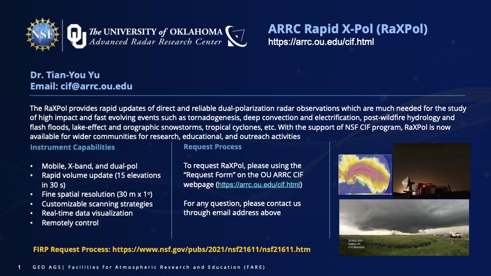
Flyer
Here is a copy of the flyer. Feel free to share it.

Data
Whenever the radar is connected to the internet, the live displays shows the last upload.
A collection of currated datasets will be available through our Data Page.
We are also currently working Amazon Web Services to host additional datasets.
Software Tools
A simple visiualization example in Python is avialable at GitHub
Calendar
Existing commitments can be viewed at the official Radar Calendar
Request
For using the RaXPol, please use the Request Form
References
- T.-Y. Yu, D. Bodine, P. Kirstetter, H. B. Bluestein, R. Palmer, M. Yeary, and B. Cheong, The Mobile Rapid Scanning X-Band Polarimetric (RaXPol) Radar as a Community Instrument Facility: Enhancing Learning Experiences in Radar Meteorology and Engineering, 32nd Conference on Education, AMS 102nd Annual Meeting, Virtual, Jan 23-27, 2022. Slides
- D. Bodine, T.-Y. Yu, P. Kirstetter, H. B. Bluestein, R. Palmer, M. Yeary, B. Cheong, M.-D. Tzeng, The Mobile Rapid-Scan X-band Polarimetric (RaXPol) Radar as a Community Instrument Facility: Providing High-Temporal Resolution, Dual-Polarization Observations for Atmospheric Science Research and Education, 37th Conference on Environmental Information Processing Technologies, AMS 102nd Annual Meeting, Virtual, Jan 23-27, 2022. Slides
