ARRC Radar Systems
Atmospheric Imaging Radar
The Atmospheric Imaging Radar (AIR) is a phased array radar that uses digital beamforming to obtain volume scans of the atmosphere in only 5 to 10 s (Isom et al. 2013; Kurdzo et al. 2017)! The AIR transmits a spoiled beam that is wide in the vertical dimension (20º in elevation) and narrow in the horizontal dimension (1º in azimuth). By receiving with 36 subarray antennas, we can perform digital beamforming to obtain 1º resolution in elevation while simultaneously covering a 20º wide vertical swath. Thus, the only mechanically scanning necessary is in azimuth.
From 2011 to 2019, we conducted experiments with the AIR to study severe thunderstorms and tornadoes in the Great Plains. Several studies have been published as a result, including scientific highlight articles in IEEE (Kurdzo et al. 2015) and BAMS (Kurdzo et al. 2017). Other more detailed case studies include an analysis of the mature stage of the Tipton, OK 16 May 2015 tornado (Mahre et al. 2018), the dissipation process of the 27 May 2015 Canadian, TX tornado (Griffin et al. 2019), and a polarimetric and phased array analysis of the Shawnee, Oklahoma 19 May 2013 tornado (Wakimoto et al. 2020). We have several additional studies underway, including studies of tornadogenesis and tornadogenesis failure cases, investigating the utility of rapid-scan data for future operational warning decisions, and analyses of horizontal vorticity bands around tornadic and nontornadic supercells. The AIR was retired in 2019 in preparation for two future dual-polarization PARs, PAIR and HORUS.
If you have an interest in working with AIR data or collaborating with us, please don't hesitate to contact us!
Check out the links below to see some animations of AIR data!
3D Rendering of Data from the 31 May 2013 El Reno Supercell:
Rapid scans of the 19 May 2013 Shawnee, OK EF-4 Tornado:
Mature and Dissipating Stages of the 27 May 2015 Canadian, TX EF-2 Tornado: Link
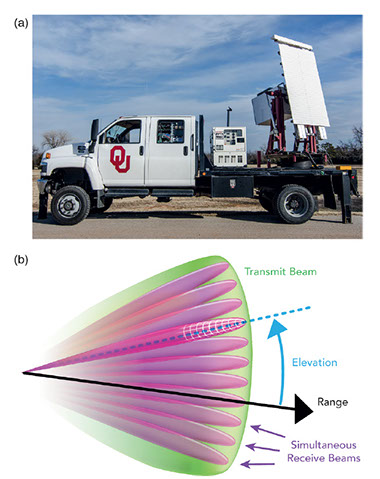
Photo of the AIR (top) and schematic of the digital beamforming (bottom), adapted from Kurdzo et al. (2017).
PX-1000 and PX-10k
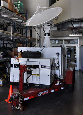
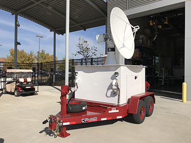
The ARRC operates two trailer-based, dual-polarization radars called the PX-1000 and PX-10k. Both radars operate dual solid-state transmitters providing flexibility on transmit and receive. The PX-1000 was completed in 2011 (Cheong et al. 2013) and was used to obtain 20-s dual-polarization scans of the 20 May 2013 EF-5 Moore, Oklahoma tornado (Kurdzo et al. 2015). In addition to the Moore study, PX-1000 has also been used during the PECAN field experiment, deployments for flash flood and fire monitoring in Colorado, winter weather experiments in South Korea, and hydrological research in Peru.
The PX-10k is the next-generation of solid-state, dual-polarization weather radars in the ARRC. Compared to the PX-1000, PX-10k will feature higher spatial and temporal resolution:
- 1.4º beamwidth and 6-m range resolution
- 1 – 2 s per PPI (Up to 360º rotation rate)
Higher temporal resolution is achieved through rapid pedestal rotation and the use of frequency hopping to obtain independent samples.
For more information about these radars, including how to request them for field experiments or obtain data access, you can check out the ARRC website or contact me directly.
20 May 2013 Moore EF-5 Tornado from PX-1000
(click here to see animation!)
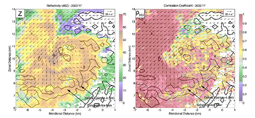
In our study of the Moore tornado (Kurdzo et al. 2015), we found that the supercell underwent a "failed" occlusion during a sequence of momentum surges, including one that pivoted the tornado back into a more favorable location for maintenance. We also identified a sequence of debris ejections associated with momentum surges in the RFD.
PX-1000
PX-10k
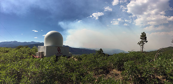
RaXPol
Description coming soon!
PX-10K (almost ready!)
